Skip to content

Our lakes

  • All Lakes
  • Regions
    • Northland
    • Auckland
    • Waikato
    • Bay of Plenty
    • Hawke’s Bay
    • Taranaki
    • Manawatū/Whanganui
    • Wellington
    • Tasman
    • West Coast
    • Marlborough
    • Canterbury
    • Otago
    • Southland
  • Coastal Lakes
  • Lowland Lakes
  • Highland Lakes
  • Alpine Lakes

Lake Emma / Kirihonuhonu

Depth: 2.3 metres

Area: 166.8 hectares

Altitude: 640 metres

Lake ID: 41299

Main vegetation type:
Low Productivity Grassland

Ashburton

Canterbury
43° 38' 19" S
171° 6' 23" E
Highland

Iwi / representative groups:

  • Ngāi Tahu
    • Te Rūnanga o Arowhenua

Description

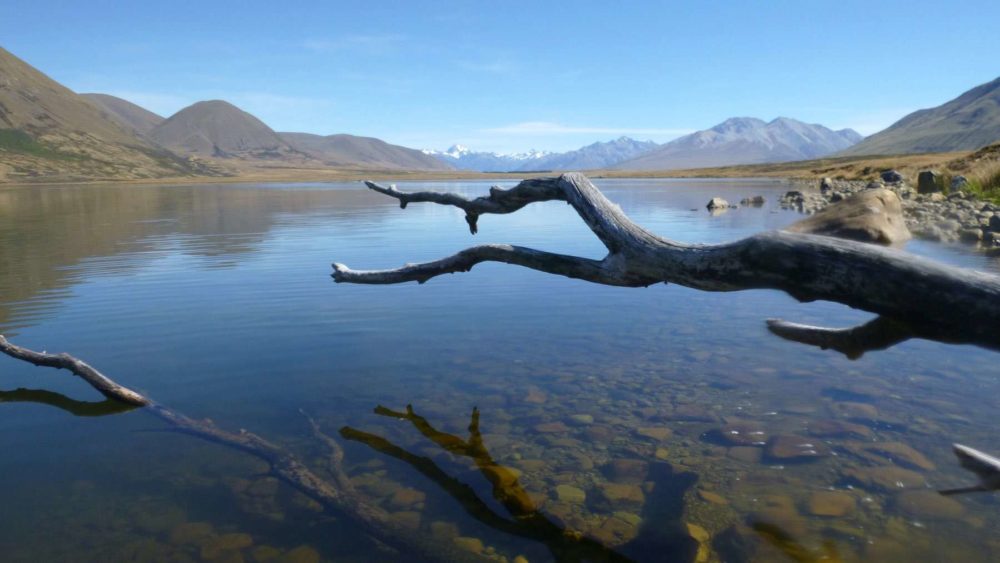
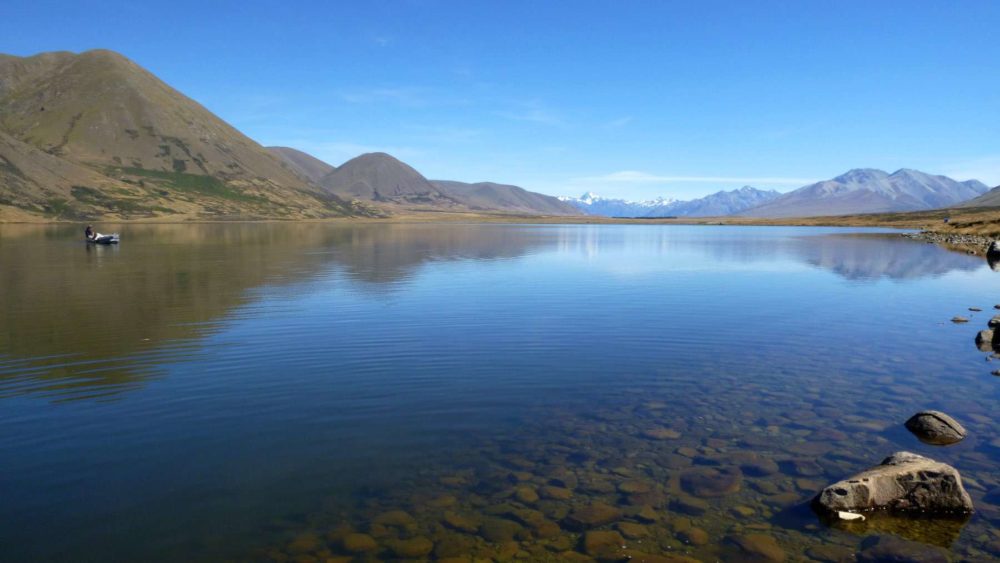
Kirihonuhonu (Lake Emma) lies between the upper reaches of the South Asburton and Rangitata rivers’, and has a maximum depth of 3 m. In summer months, the lake has been susceptible to high nutrient levels and algal biomass concentrations.  However, nutrient levels and algal productivity have fallen in recent years. The lake is popular for water activities and fishing (source lawa.co.nz).

Kirihonuhonu is part of the rich high-country mahinga kai area of Ōtūwharekai (the Ashburton Lakes).  The lake is kāinga mahinga kai (food-gathering place) for Ngāi Tahu where tuna (eels), aruhe (bracken fernroot), and weka were gathered (https://www.kahurumanu.co.nz/atlas).

41299

Download information sheet

Sediment core

Loading...

Lake Hay

Fiordland National Park

Southland

Lake Dudding

Bulls

Manawatū Whanganui

Te Ana-au / Lake Te Anau

Te Anau

Southland

Pyramid Lake

Fiordland National Park

Southland

Lake Johnson / Waipuna

Queenstown

Otago

Lake Paringa

Haast

West Coast

Explore our lakes

See all lakes
Lakes 380 reversed logo
About
  • The Project
  • The Science
    • Field Sampling
    • Laboratory Analysis
    • Student Projects
  • Science Aims
  • Rohe Studies
    • Rangitīkei Iwi Rohe Study
    • Wairarapa Moana iwi rohe study
  • Virtual Experience
  • Social Science
  • Iwi Relationships
  • The Team
    • Advisory Groups
    • Lakes380 Co-lead Institutes​
    • National Collaborators
    • International Collaborators
  • Partners
Our Lakes
  • All Lakes
  • Regions
    • Northland
    • Auckland
    • Waikato
    • Bay of Plenty
    • Hawke’s Bay
    • Taranaki
    • Manawatū/Whanganui
    • Wellington
    • Tasman
    • West Coast
    • Marlborough
    • Canterbury
    • Otago
    • Southland
  • Coastal Lakes
  • Lowland Lakes
  • Highland Lakes
  • Alpine Lakes
Resources
  • Contact & Links
  • Blog, News & Publications
  • Video Gallery
  • Results
  • Glossary
Contact Us

Email us

Twitter Instagram Envelope
Sign up to our newsletter for updates
Our Privacy Policy | Our Copyright Policy

© 2023 Lakes380 Project

Home

Our Lakes

  • All Lakes
  • Regions
    • Northland
    • Auckland
    • Waikato
    • Bay of Plenty
    • Hawke’s Bay
    • Taranaki
    • Manawatū/Whanganui
    • Wellington
    • Tasman
    • West Coast
    • Marlborough
    • Canterbury
    • Otago
    • Southland
  • Coastal Lakes
  • Lowland Lakes
  • Highland Lakes
  • Alpine Lakes

About

  • The Project
  • The Science
    • Field Sampling
    • Laboratory Analysis
    • Student Projects
  • Science Aims
  • Rohe Studies
    • Rangitīkei Iwi Rohe Study
    • Wairarapa Moana iwi rohe study
  • Virtual Experience
  • Social Science
  • Iwi Relationships
  • The Team
    • Advisory Groups
    • Lakes380 Co-lead Institutes​
    • National Collaborators
    • International Collaborators
  • Partners

Resources

  • Contact & Links
  • Blog, News & Publications
  • Video Gallery
  • Results
  • Glossary