Skip to content

Our lakes

  • All Lakes
  • Regions
    • Northland
    • Auckland
    • Waikato
    • Bay of Plenty
    • Hawke’s Bay
    • Taranaki
    • Manawatū/Whanganui
    • Wellington
    • Tasman
    • West Coast
    • Marlborough
    • Canterbury
    • Otago
    • Southland
  • Coastal Lakes
  • Lowland Lakes
  • Highland Lakes
  • Alpine Lakes
Menu
  • All Lakes
  • Regions
    • Northland
    • Auckland
    • Waikato
    • Bay of Plenty
    • Hawke’s Bay
    • Taranaki
    • Manawatū/Whanganui
    • Wellington
    • Tasman
    • West Coast
    • Marlborough
    • Canterbury
    • Otago
    • Southland
  • Coastal Lakes
  • Lowland Lakes
  • Highland Lakes
  • Alpine Lakes

Lake Pearson / Ōpōrea

Depth: 17.5 metres

Area: 201.9 hectares

Altitude: 603 metres

Lake ID: 48660

Main vegetation type:
Low Productivity Grassland

Arthur’s Pass

Canterbury
43° 6' 10" S
171° 46' 41" E
Highland

Iwi / representative groups:

  • Ngāi Tahu
    • Te Ngāi Tūāhuriri Rūnanga

Description

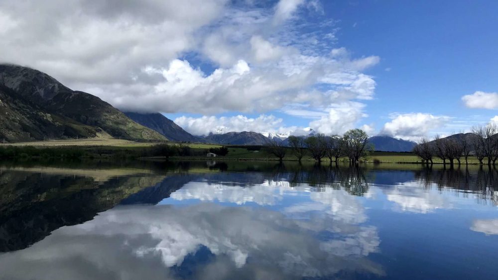
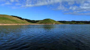
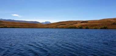
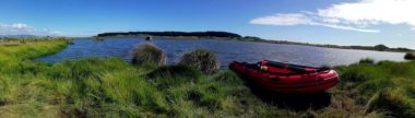
Ōpōrea is the traditional Māori name for Lake Pearson.  It is also known as Moanarua.  It is a moderate sized highland lake, situated in the upper Waimakariri River catchment. Traditionally this lake was valued among local Māori as a mahinga kai (food bowl) site (source www.kahurumanu.co.nz/atlas).

The lake is considered to have low-moderate nutrient enrichment levels, with relatively clear water. The lake covers an area of 43.2 hectares, with a maximum depth of 17.5 m (source lawa.co.nz).

48660

Download information sheet

Sediment core

Loading...

Lake Lucille

Fiordland National Park

Southland

Lake Kāurupātaka

Arthur’s Pass National Park

West Coast

Lake Kohangapiripiri

Wellington Harbour Heads

Wellington

Lake Rotoiti (Rotorua)

Rotorua

Bay of Plenty

Lake Areare

North of Hamilton

Waikato

Lake Hawdon

Arthurs Pass

Canterbury

Explore our lakes

See all lakes
Lakes 380 reversed logo
About
Menu
  • The Project
  • The Science
    • Field Sampling
    • Laboratory Analysis
    • Student Projects
  • Science Aims
  • Rohe Studies
    • Rangitīkei Iwi Rohe Study
    • Wairarapa Moana iwi rohe study
  • Virtual Experience
  • Social Science
  • Iwi Relationships
  • The Team
    • Advisory Groups
    • Lakes380 Co-lead Institutes​
    • National Collaborators
    • International Collaborators
  • Partners
Our Lakes
Menu
  • All Lakes
  • Regions
    • Northland
    • Auckland
    • Waikato
    • Bay of Plenty
    • Hawke’s Bay
    • Taranaki
    • Manawatū/Whanganui
    • Wellington
    • Tasman
    • West Coast
    • Marlborough
    • Canterbury
    • Otago
    • Southland
  • Coastal Lakes
  • Lowland Lakes
  • Highland Lakes
  • Alpine Lakes
Resources
Menu
  • Contact & Links
  • Blog, News & Publications
  • Video Gallery
  • Results
  • Glossary
Contact Us

Email us

Twitter Instagram Envelope
Sign up to our newsletter for updates
Our Privacy Policy | Our Copyright Policy

© 2022 Lakes380 Project

Home

Our Lakes

Menu
  • All Lakes
  • Regions
    • Northland
    • Auckland
    • Waikato
    • Bay of Plenty
    • Hawke’s Bay
    • Taranaki
    • Manawatū/Whanganui
    • Wellington
    • Tasman
    • West Coast
    • Marlborough
    • Canterbury
    • Otago
    • Southland
  • Coastal Lakes
  • Lowland Lakes
  • Highland Lakes
  • Alpine Lakes

About

Menu
  • The Project
  • The Science
    • Field Sampling
    • Laboratory Analysis
    • Student Projects
  • Science Aims
  • Rohe Studies
    • Rangitīkei Iwi Rohe Study
    • Wairarapa Moana iwi rohe study
  • Virtual Experience
  • Social Science
  • Iwi Relationships
  • The Team
    • Advisory Groups
    • Lakes380 Co-lead Institutes​
    • National Collaborators
    • International Collaborators
  • Partners

Resources

Menu
  • Contact & Links
  • Blog, News & Publications
  • Video Gallery
  • Results
  • Glossary