Skip to content

Our lakes

  • All Lakes
  • Regions
    • Northland
    • Auckland
    • Waikato
    • Bay of Plenty
    • Hawke’s Bay
    • Taranaki
    • Manawatū/Whanganui
    • Wellington
    • Tasman
    • West Coast
    • Marlborough
    • Canterbury
    • Otago
    • Southland
  • Coastal Lakes
  • Lowland Lakes
  • Highland Lakes
  • Alpine Lakes

Lake Hurimoana

Depth: 12 metres

Area: 20.2 hectares

Altitude: 38 metres

Lake ID: 36285

Main vegetation type:
High Productivity Grassland

Napier

Hawke's Bay
39° 33' 12" S
176° 43' 10" E
Lowland

Iwi / representative groups:

  • Ahuriri Hapū
    • Heretaunga Tamatea

      Description

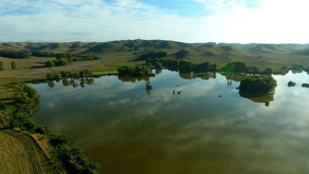
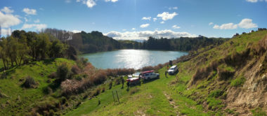
      Hurimoana Swamp is a lowland system that lies slightly inland of Napier and Hastings. The swamp covers an area of approximately 20.2 hectares, has a maximum depth of 12 m and is surrounded by high productivity grassland.

      36285
      Loading...

      Lake Rerewhakaaitu

      Rotorua

      Bay of Plenty

      Lake Gow

      Garvie Mountains

      Southland

      Lake Koitiata

      Bulls

      Manawatū Whanganui

      Lake Kāurupātaka

      Arthur’s Pass National Park

      West Coast

      Lake Wainui

      Pouto Peninsula 

      Northland

      Lake Clearwater / Te Puna-a-Taka

      Ashburton

      Canterbury

      Explore our lakes

      See all lakes
      Lakes 380 reversed logo
      About
      • The Project
      • The Science
        • Field Sampling
        • Laboratory Analysis
        • Student Projects
      • Science Aims
      • Rohe Studies
        • Rangitīkei Iwi Rohe Study
        • Wairarapa Moana iwi rohe study
      • Virtual Experience
      • Social Science
      • Iwi Relationships
      • The Team
        • Advisory Groups
        • Lakes380 Co-lead Institutes​
        • National Collaborators
        • International Collaborators
      • Partners
      Our Lakes
      • All Lakes
      • Regions
        • Northland
        • Auckland
        • Waikato
        • Bay of Plenty
        • Hawke’s Bay
        • Taranaki
        • Manawatū/Whanganui
        • Wellington
        • Tasman
        • West Coast
        • Marlborough
        • Canterbury
        • Otago
        • Southland
      • Coastal Lakes
      • Lowland Lakes
      • Highland Lakes
      • Alpine Lakes
      Resources
      • Contact & Links
      • Blog, News & Publications
      • Video Gallery
      • Results
      • Glossary
      Contact Us

      Email us

      Twitter Instagram Envelope
      Sign up to our newsletter for updates
      Our Privacy Policy | Our Copyright Policy

      © 2023 Lakes380 Project

      Home

      Our Lakes

      • All Lakes
      • Regions
        • Northland
        • Auckland
        • Waikato
        • Bay of Plenty
        • Hawke’s Bay
        • Taranaki
        • Manawatū/Whanganui
        • Wellington
        • Tasman
        • West Coast
        • Marlborough
        • Canterbury
        • Otago
        • Southland
      • Coastal Lakes
      • Lowland Lakes
      • Highland Lakes
      • Alpine Lakes

      About

      • The Project
      • The Science
        • Field Sampling
        • Laboratory Analysis
        • Student Projects
      • Science Aims
      • Rohe Studies
        • Rangitīkei Iwi Rohe Study
        • Wairarapa Moana iwi rohe study
      • Virtual Experience
      • Social Science
      • Iwi Relationships
      • The Team
        • Advisory Groups
        • Lakes380 Co-lead Institutes​
        • National Collaborators
        • International Collaborators
      • Partners

      Resources

      • Contact & Links
      • Blog, News & Publications
      • Video Gallery
      • Results
      • Glossary