Our lakes

  • All Lakes
  • Regions
    • Northland
    • Auckland
    • Waikato
    • Bay of Plenty
    • Hawke’s Bay
    • Taranaki
    • Manawatū/Whanganui
    • Wellington
    • Tasman
    • West Coast
    • Marlborough
    • Canterbury
    • Otago
    • Southland
  • Coastal Lakes
  • Lowland Lakes
  • Highland Lakes
  • Alpine Lakes
Menu
  • All Lakes
  • Regions
    • Northland
    • Auckland
    • Waikato
    • Bay of Plenty
    • Hawke’s Bay
    • Taranaki
    • Manawatū/Whanganui
    • Wellington
    • Tasman
    • West Coast
    • Marlborough
    • Canterbury
    • Otago
    • Southland
  • Coastal Lakes
  • Lowland Lakes
  • Highland Lakes
  • Alpine Lakes

Lake Ianthe

Depth: 28 metres

Area: 470.8 hectares

Altitude: 9 metres

Lake ID: 47491

Main vegetation type:
Indigenous Forest

Hokitika

West Coast
43° 3' 23" S
170° 37' 32" E
Lowland

Iwi / representative groups:

  • Ngāi Tahu
    • Te Rūnanga o Makaawhio

Description

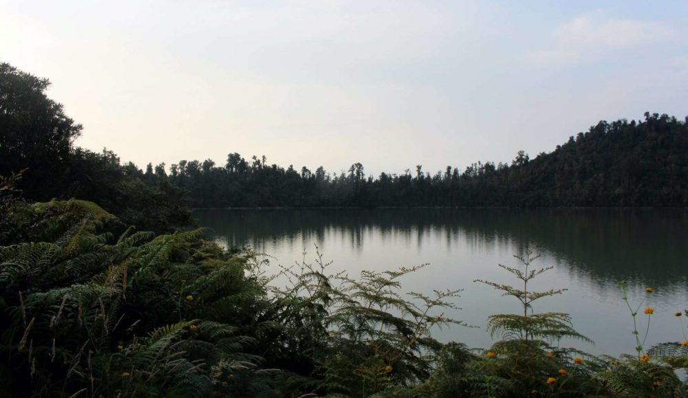
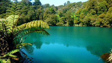
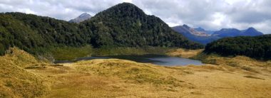
Lake Ianthe is a large body of open water mostly surrounded by hill slopes of indigenous podocarp forest, with a large flax swamp at its southern end. The lake supports a substantial diversity of wetland birds, including perhaps Westland’s largest population of Great Crested Grebe, an endangered species in New Zealand. The lake occupies the depression created by the lobe of a former glacial trough, and is surrounded on three sides by a moraine extending from the Wanganui River valley. The southern shores are bordered by swampy alluvial flats of recent geological origin. Two small creeks flow into the northern end of the lake, and the lake and swamp drain via Ianthe Creek into the Wanganui River. The lake has a maximum recorded depth of approximately 32 m towards the northern end, but more than half of the lake is less than 6 m deep.

47491

Lake William

Bulls

Manawatū Whanganui

East Kaihoka Lake / Tinawhu

Golden Bay

Tasman

Lake Luna

Richardson Mountains

Otago

Lake Whangape

North West of Huntly

Waikato

Lake Rotoehu

Rotorua

Bay of Plenty

Horseshoe Lake (Canterbury)

Lewis Pass

Canterbury

Explore our lakes

See all lakes
Lakes 380 reversed logo
About
Menu
  • The Project
  • The Science
    • Field Sampling
    • Laboratory Analysis
    • Student Projects
  • Science Aims
  • Rohe Studies
    • Rangitīkei Iwi Rohe Study
    • Wairarapa Moana iwi rohe study
  • Social Science
  • Iwi Relationships
  • The Team
    • Advisory Groups
    • Lakes380 Co-lead Institutes​
    • National Collaborators
    • International Collaborators
  • Partners
Our Lakes
Menu
  • All Lakes
  • Regions
    • Northland
    • Auckland
    • Waikato
    • Bay of Plenty
    • Hawke’s Bay
    • Taranaki
    • Manawatū/Whanganui
    • Wellington
    • Tasman
    • West Coast
    • Marlborough
    • Canterbury
    • Otago
    • Southland
  • Coastal Lakes
  • Lowland Lakes
  • Highland Lakes
  • Alpine Lakes
Resources
Menu
  • Contact & Links
  • Blog, News & Publications
  • Video Gallery
  • Results
  • Glossary
Contact Us

Email us

Twitter
Instagram
Envelope
Sign up to our newsletter for updates
Our Privacy Policy | Our Copyright Policy

© 2021 Lakes380 Project

Home

Our Lakes

Menu
  • All Lakes
  • Regions
    • Northland
    • Auckland
    • Waikato
    • Bay of Plenty
    • Hawke’s Bay
    • Taranaki
    • Manawatū/Whanganui
    • Wellington
    • Tasman
    • West Coast
    • Marlborough
    • Canterbury
    • Otago
    • Southland
  • Coastal Lakes
  • Lowland Lakes
  • Highland Lakes
  • Alpine Lakes

About

Menu
  • The Project
  • The Science
    • Field Sampling
    • Laboratory Analysis
    • Student Projects
  • Science Aims
  • Rohe Studies
    • Rangitīkei Iwi Rohe Study
    • Wairarapa Moana iwi rohe study
  • Social Science
  • Iwi Relationships
  • The Team
    • Advisory Groups
    • Lakes380 Co-lead Institutes​
    • National Collaborators
    • International Collaborators
  • Partners

Resources

Menu
  • Contact & Links
  • Blog, News & Publications
  • Video Gallery
  • Results
  • Glossary