

Lake Hāwea
Lake Hāwea stretches 35 kilometres from north to south. It lies in a glacial valley formed during the last ice age, and is fed by the Hunter River. Nearby Lake Wānaka lies in a parallel glacial valley eight kilometres to the west. At their closest point, a rocky ridge called The Neck, the lakes are […]
Te Ana-au / Lake Te Anau
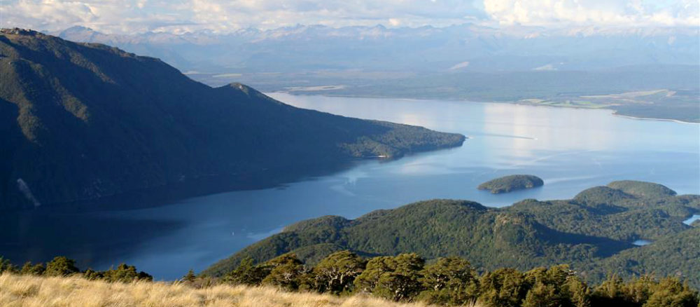
Lake Te Ana-au (Te Anau) lies in the south west of South Island New Zealand (www.kahurumanu.co.nz/atlas). The lake is the largest in the South Island, and second only to Lake Taupō in the North Island. With the surface of the lake at an altitude of 210 m and a depth of over 410m at its […]
Moturau / Lake Manapōuri
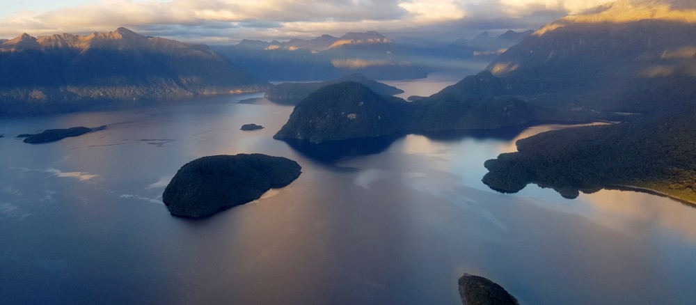
Moturau is the correct Māori name for Lake Manapōuri. Manapōuri is the name for Shallow Bay in the eastern part of the lake. The name Manapōuri has been incorrectly applied to the entire lake (www.kahurumanu.co.nz/atlas).Motuau was formed by deep cutting glaciers during the last Holocene. At 444m deep it is New Zealand’s second deepest lake. […]
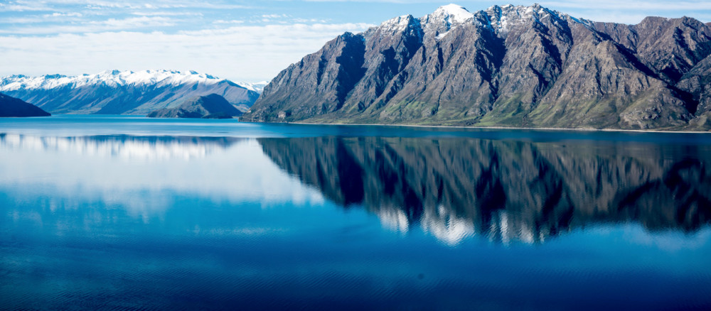
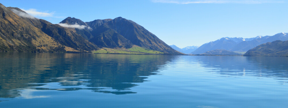
Lake Wānaka
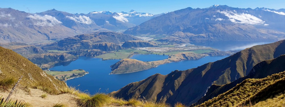
Lake Wānaka, New Zealand’s fourth-largest lake, lies in a u-shaped valley formed by glacial erosion during the last ice age more than 10,000 years ago. It is fed by the Mātukituki and Makarora Rivers and is the source of the Clutha River / Mata-Au, whose outflow is close to Wānaka township on the southern shore. […]
Lake Ōhau
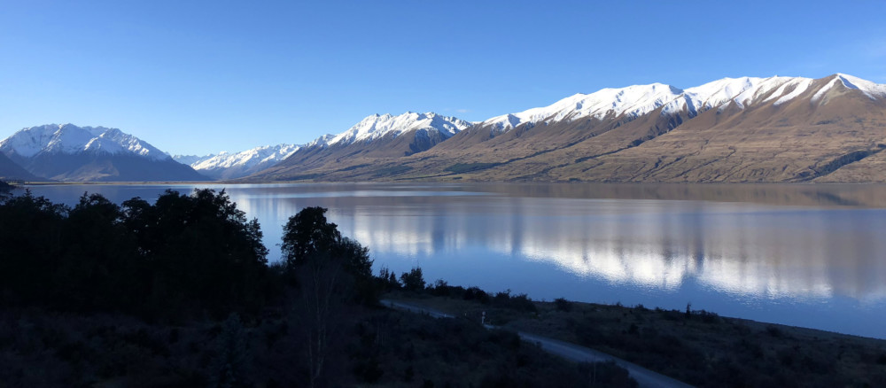
Lake Ōhau is a glacial lake in Te Manahuna (the Mackenzie Basin), fed by Te Awa Aruhe (Hopkins River) and Ōtaao (Dobson River). The lake’s water quality is very good and the ecological condition is excellent (www.lawa.org.nz). The lake is surrounded by tussock land that suffers from grazing by introduced himalayan thar. Lake Ōhau Alpine […]
Lake Pukaki
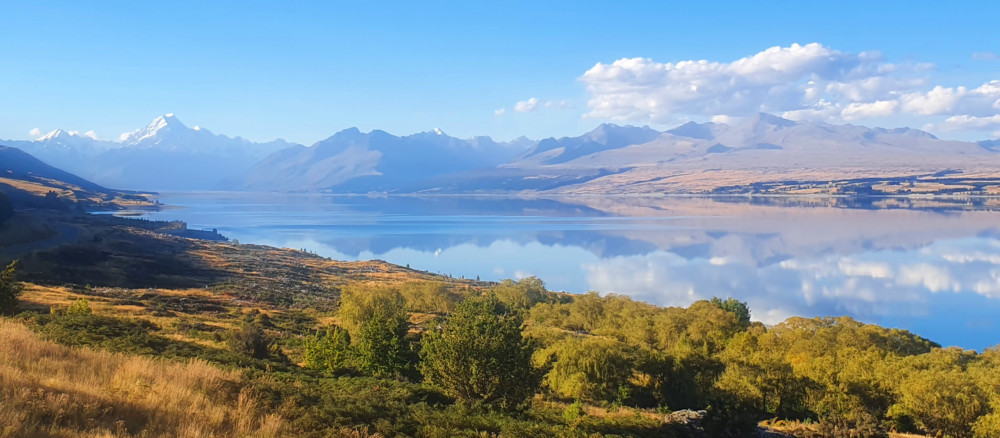
Lake Pukaki is a large glacial fed lake located between Tekapo and Twizel. Aoraki / Mount Cook towers above the northern end of the lake and on a clear day can be seen 70 kilometres away from the southern shore of the lake.Lake Pukaki formed when the terminal moraines of receding glaciers blocked the valley, […]
Takapō / Lake Tekapo
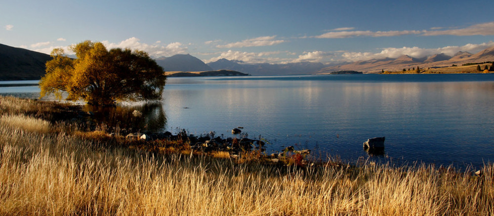
Takapō (Lake Tekapo) is a large glacial fed lake located near the Lake Tekapo township on the north edge of Te Manahuna (Mackenzie Basin). The lake is surrounded by tall peaks and hills with the Godley and Macauley rivers flowing into the northern end of Takapō, from the Southern Alps. Lake Tekapo Regional Park, is […]
Lake Rotoroa
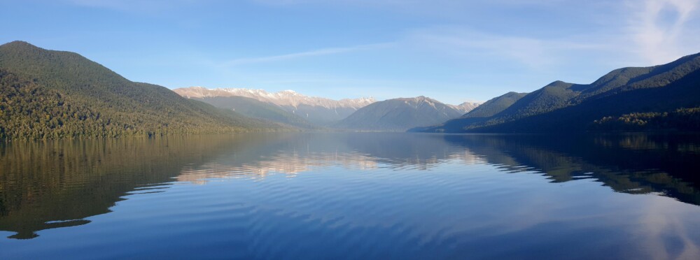
Lake Rotoroa is the larger of the two large glacial lakes in Nelson Lakes National Park. The lakes were formed when rivers were dammed behind past glaciers’ terminal moraines (ridges of rubble that form at the front of a glacier) (source www.teara.govt.nz). Lake Rotoroa (meaning long lake in maori) is a long deep lake nestled […]
Whakamatau / Lake Coleridge
The glacially carved Whakamatau (Lake Coleridge) is located north of the Rakaia River in the Canterbury high country. Whakamatau was an important place to rest and replenish supplies (mahinga kai) for Ngai Tahu who gathered kakapo, weka, and tuna here, on route to the West Coast (https://www.kahurumanu.co.nz/atlas).Lake Coleridge was the first government-built Hydro Electric Power […]
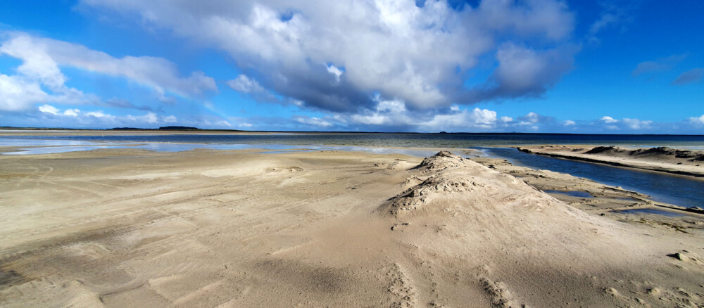
Te Whanga Lagoon
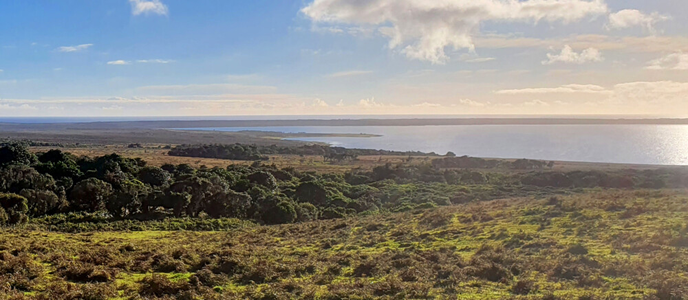
Te Whanga Lagoon is the largest waterbody on Chatham Island and is prized for its recreation and food gathering values, as well as having high cultural values. It is predominantly a brackish or saline environment, due to periodic openings to the sea. It has moderate to high nutrient levels and sometimes suffers from algal blooms. […]
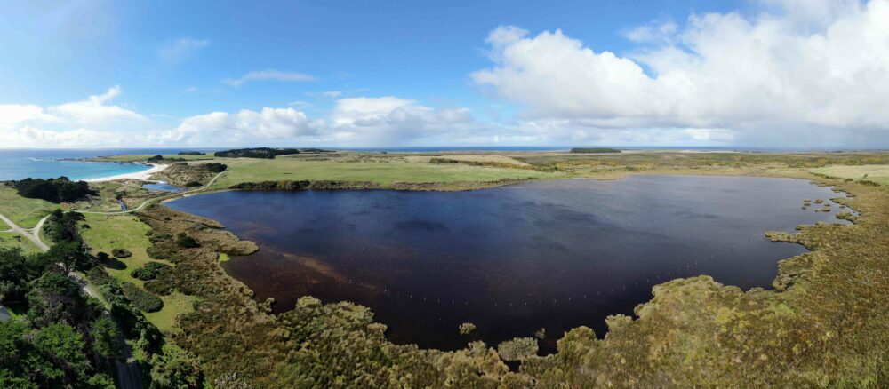
Lake Pateriki
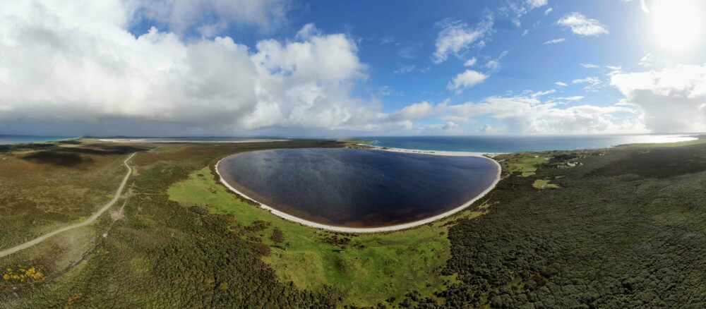
Lake Pateriki is a coastal dune lake in the north east of Chatham Island. The lake bed is sandy and the lake has saline, tea stained water. Its norther margin is bordered by sand dune. Main image by David G. Schmale III, Virginia Tech, https://www.schmalelab.spes.vt.edu/
Lake Te Wapu
Te Wapu is a coastal dune lake in the north east of Chatham Island close to Kaingaroa, the Skirmish Bay settlement. The lake shows high levels of nutrient enrichment, with poor water quality and algal blooms (ECAN). Main image by David G. Schmale III, Virginia Tech, https://www.schmalelab.spes.vt.edu/
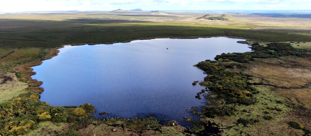
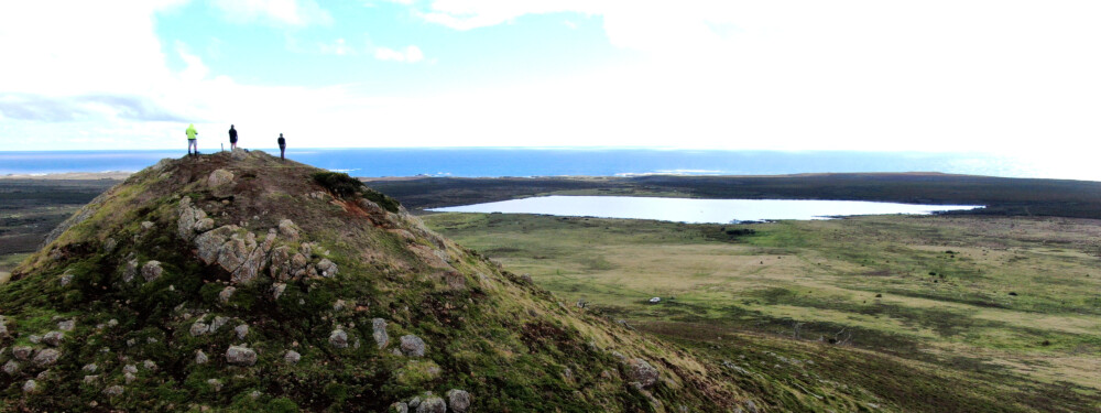
Rangitahi Lake
Rangitahi Lake (sometimes spelt Rangitai) is located between Te Whanga Lagoon and Lake Pateriki in north east Chatham Island. Lake Rangitahi is a dune-dammed lake. It is clearer than nearby lakes, with over 10 m underwater visibility. The lake supplies water to the settlement of Kaingaroa some 6km away.
Lake Rotoeka
Lake Rotoeka is a small shallow tannin stained peat lake situated in the north of Chatham Island. Main image byDavid G. Schmale III, Virginia Tech, https://www.schmalelab.spes.vt.edu/
Lake by Tangoio Creek
The unnamed shallow, tannin stained peat lake close to Tangoio Creek drains east, via Tangoio Creek, to the coast. It is located on the western end of Chathams Island’s north western arm. Main image byDavid G. Schmale III, Virginia Tech, https://www.schmalelab.spes.vt.edu/